I was up at
5:30 a.m., ate at the motel’s breakfast nook and checked out at 7:30. I stopped at the Alon Station at the 7-11, as
they advertised gas at $2.009/gallon for their low-octane gas – a nickel or so
cheaper than the neighboring stations. I
used my credit card and saw on the receipt that I was charged $2.309 for their
mid-grade gasoline! I complained, and
was told that I “must have pushed the wrong button”!! I had not, as I was very careful about
that. “Well, you will have to call our
Corporate Number”. These people are
rip-offs and will get no more of my business!
I took
Highway 152 west from town. Along here,
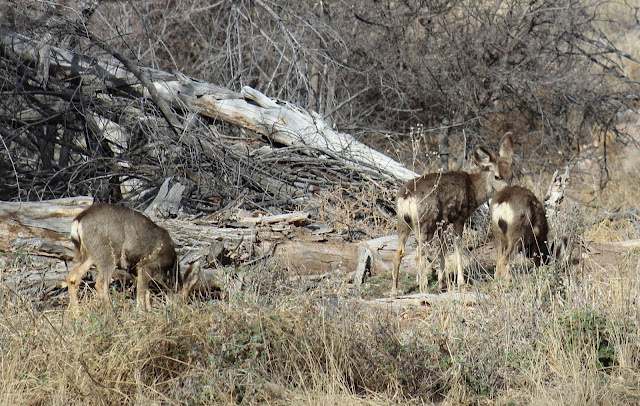
I saw some small mule deer that I presume are the desert subspecies.
 |
| If these are "Desert" mule deer, they would be Odocoileus hemionus eremicus |
Driving over
Emory Pass, which was quite the winding road,
you can still see scars on the
top of the ridge from the 2013 wild fire.
Extreme
drought fueled several big wildfires in New Mexico during June 2013. Lightning ignited the Silver Fire in a
rugged, forested area east of Silver City, New Mexico on June 7th,
and caused the evacuation of the town of Kingston.
The fire burned to the bottom of the South Percha Creek canyon.
I don't know if this stream had Gila trout or gizzard shad, but really hot fires cause pretty significant ecological damage.
It was quite
windy on top of the mountain, but the views were great.
About 15
miles east of Silver City, I saw some mine tailings.
These proved to be from the Chino Mine, an open-pit copper mine. The
excavation is also known as the Santa Rita Mine or Santa Rita del Cobre, named
for the former village of Santa Rita, which was removed in the 1950s as mining
operations in the area expanded.The open pit operation was begun in 1910, and is currently about 1¾ miles across and 1,350 feet deep.
I stopped at
Silver City to do a few errands, then gassed up to continue south on Highway 90
where I crossed the Continental Divide.
This road
intersects Interstate 10 at Lordsburg, then I continued south on Highway 80 to
Rodeo. I stopped at the Chiricahua
Desert Museum to view the exhibits, and watch a few birds.
There is the Apache Museum associated with the facility.
They have quite the cactus garden.
There were a few birds in the garden, in spite of the fact that they hadn't filled their feeders for quite a while.
I tried to
find “The BioResearch Ranch”, where I heard that C.D. Littlefield - the author of Birds of Malheur NWR - was
staying. I could not make it very far
south of town on the washed out desert dirt roads, because the Subaru just
didn’t have enough clearance. So, I
headed back to Rodeo and took the road across the State Line to Portal,
Arizona. I went up to the US Forest
Service information center in the old Ranger Station, then back to Cave Creek
Ranch, and waited for Laura. While I
waited, I paid the $5 “Visitors’ Fee”, which allows them to continue feeding
the birds.
 |
| Black-throated Sparrow |
 |
| Curve-billed Thrashe |
When she
arrived, I found that they were full and had no vacancies. So, I drove into “downtown” Portal and got a
room at the Portal Peak Lodge for $90.14.
They have a good restaurant there, so I had supper of their
mesquite-grilled chicken and 2 pints of beer.
Chiricahua
Desert Museum eBird Checklist is Here
Cave Creek
Ranch eBird Checklist is Here


No comments:
Post a Comment